Travel to School
Car & Walking
The traffic in Kings Heath at the start and end of the school day is often heavy, with several schools as well as through traffic. To improve air quality and safety for students, see if there is somewhere on the map below you can drop your children off and allow them to walk the rest of the way.
Please do not drive onto the school site (including the area in front of the gates) to drop off or pick up your child at the start and end of the school day.
This map shows the walking area from school and the distance in time. When dropping off or picking up students, please park outside the 0-5minute area.
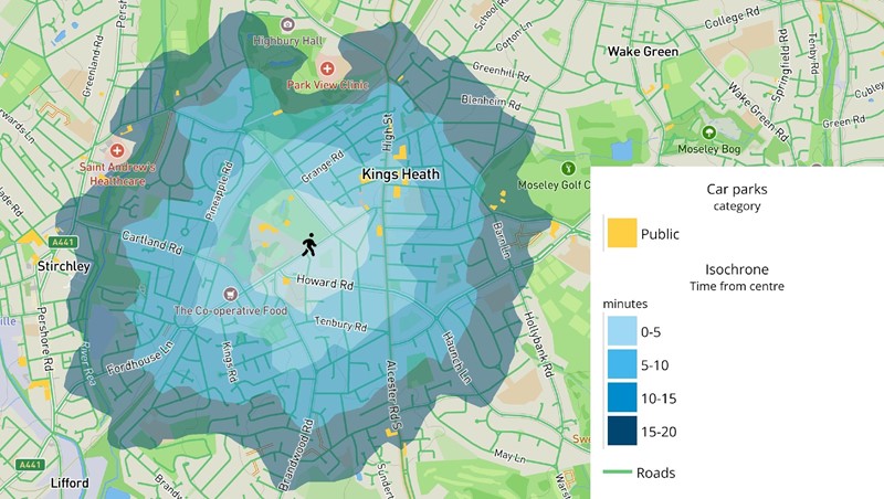
The highlighted yellow areas are public car parks where students could be dropped off - walking even part of the journey will allow them to exercise and spend time with friends.
Bike
To encourage active modes of transport, the school has plenty of bicycle storage available for those wanting to cycle to school. The map below shows the areas less than 20 minutes from the school.
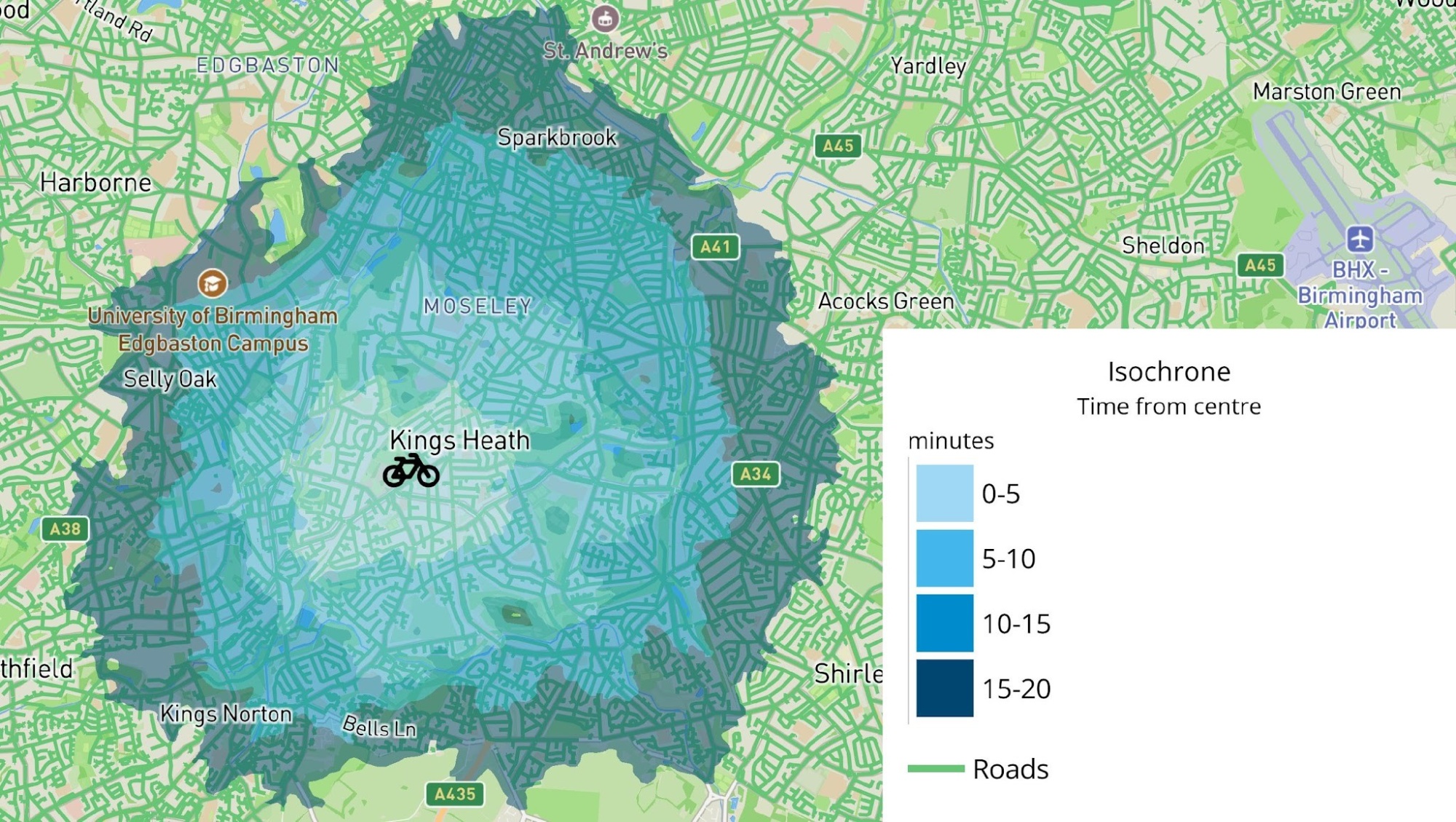
There are many areas that are easy to cycle through near the school, especially Kings Heath park, allowing time to exercise and unwind.
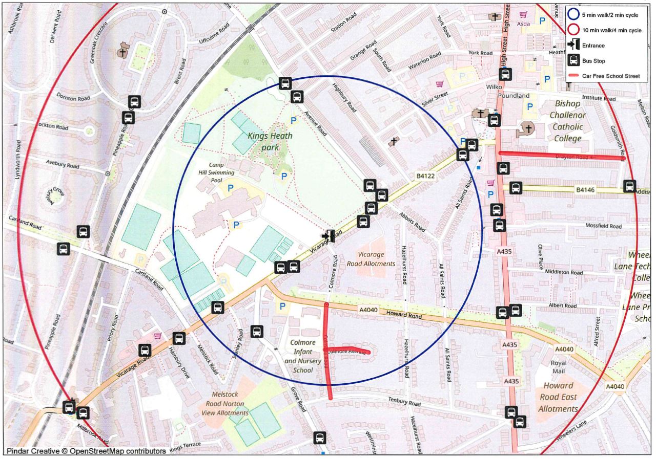
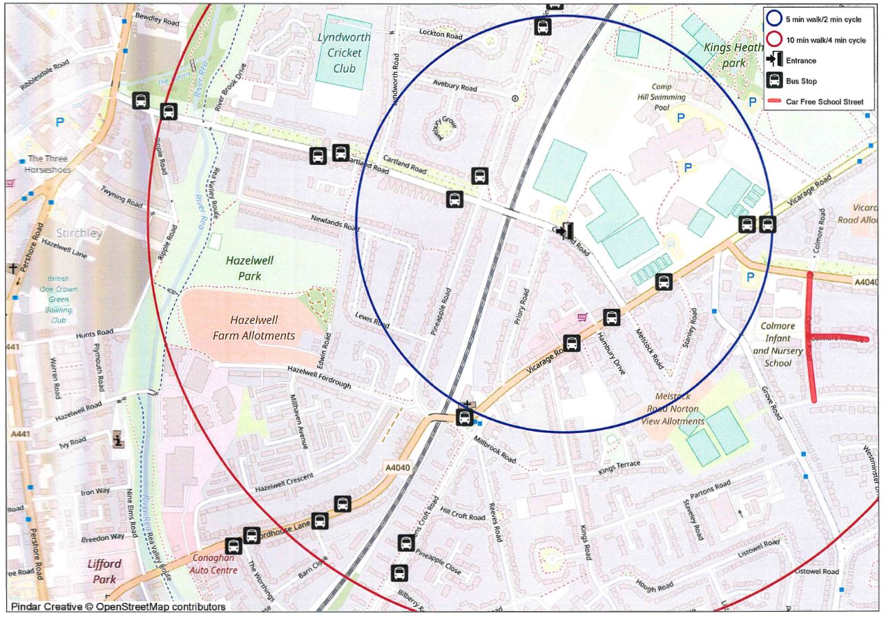
Maps to help plan your child's active travel to school:
Vicarage Road gate (main gate):
Cartland Road gate:
Bus Routes
The school is on or close to a range of Network West Midlands Bus routes.
These include:
- 11A Outer Circle – Anticlockwise
- 11C Outer Circle – Clockwise
- 18 Yardley Wood – Bartley Green
- 27 Parsons Hill – Kings Heath
- 35 City Centre – Pool Farm
- 50 City Centre – Druids Heath
- 50A City Centre – Walsall
- 76 Solihull – Queen Elizabeth Hospital
- 69 Weoley Castle – Kings Heath – Yardley Wood
- 169 Kings Heath - Solihull
For further information about routes, times and costs for bus passes, please visit their website: https://www.tfwm.org.uk/